- Home
- Focus Areas
- Earth Observation & Geodata
- Home
- Focus Areas
- Earth Observation & Geodata
Earth Observation and Geodata
Satellite-Based Earth Observation: New Perspectives for Spatial Planning, Transportation, Environment and Disaster Management with a View from Space
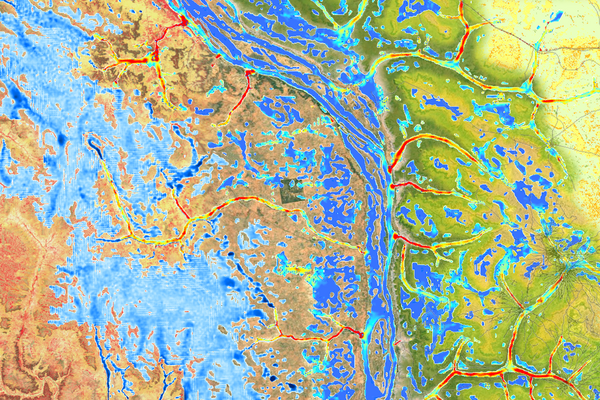
Precise and up-to-date data are essential for planning major infrastructure projects and environmental protection initiatives. This need extends to the management of natural disasters and urban development as well. The Sentinel satellites, part of the European Copernicus Earth observation program, serve as ideal data providers for these purposes. Although their presence, hundreds of kilometers above Earth, often goes unnoticed, the data they collect consistently enhances the quality of our daily lives and, most importantly, keeps us safer.
The key to unlocking valuable insights lies in the professional processing of raw satellite data, combined with analysis and interpretation by experienced experts. By examining the data in its spatial context and using multi-temporal imagery and computer simulations, it is possible to draw conclusions and filter out information that is essential for decision making.
Reacting Faster and Better in the Event of a Disaster
In disaster management, for example, geodata provides information for crisis prevention and management in the event of extreme events such as floods, earthquakes or fowildfires. This data enables the identification of at-risk buildings or areas in advance, allowing for preventive measures to be taken. If a disaster does occur, geoservices provide rapid and accurate support in analyzing the situation and developing a comprehensive situational overview.
In the future, satellite-based Earth observation will also contribute to reliable assessments of air and water quality. This data will support the issuance of precise health warnings and, during epidemics, assist in planning effective containment strategies. Additionally, satellite data aids in addressing climate change by identifying heat islands, which pose significant health risks, in a timely manner.
IABG Experts: Internationally Sought-After Project Partners
IABG collaborates on numerous Earth observation projects with multinational organizations such as the World Bank and European institutions like the European Space Agency (ESA). These large international projects typically focus on specific areas such as disaster prevention, climate research, security or forestry. One example is the Global Development Assistance (GDA) program initiated by ESA, which focuses on transport and infrastructure among other areas. Under IABG's consortium leadership, Earth observation data is leveraged to support the development of safe and environmentally friendly transportation systems. The goal is to enhance transportation options while simultaneously reducing traffic accidents and air pollution.
Digital maps and models generated by geoservices provide invaluable information for infrastructure projects, whether in urban settings or remote areas. In previously undeveloped regions, planners can identify potential risks to ecosystems or habitats of rare species - risks that might easily be overlooked through terrestrial surveys alone. This approach ensures that planning and implementation are carried out sustainably, balancing cost-efficiency with environmental responsibility.
Full-Service Solutions for Policy and Business Decision-Makers
For decision-makers in both the political and business arenas, geospatial and environmental services are vital tools for addressing some of today’s most pressing challenges. As ecological and societal changes continue to evolve, the importance of these services will only grow. IABG’s experts in the fields of remote sensing, geographic information systems (GIS), environmental sciences and engineering combine a comprehensive aerial perspective with top-tier analysis to offer a full range of services.
How can we help you?
Please fill in the form and we will get in touch with you as soon as possible.


